(or scroll down)
Genealogy Home
Geographic Features of Cherokee
County
(or scroll down)
Genealogy Home
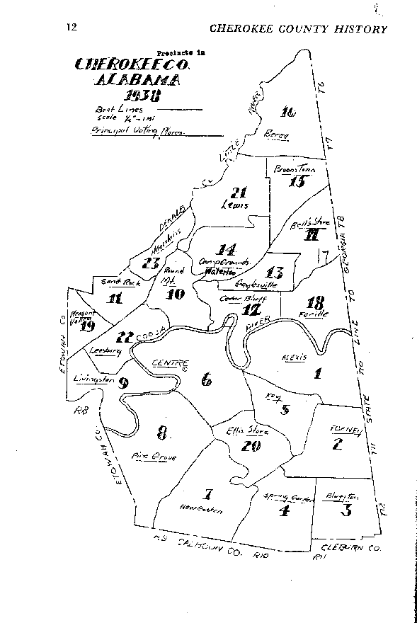
Note the map shows principal voting places, while the chart below shows names of precincts. The map was published in "Cherokee County History 1836-1956," (vol. 1) by Mrs. Frank Ross (Margaret) Stewart, in 1958.
Names of Precincts, 1890-1950
| 1900 Census District |
Precinct No. |
Precinct Name |
| 116 |
1 |
Mud Creek |
| 117 |
2 |
Rock Run |
| 118 |
3 |
Tecumseh |
| 119 |
4 |
Spring Garden |
| 120 |
5 |
Spring Creek |
| 121 |
6 |
Centre incl. Centre town |
| 122 |
7 |
Coloma |
| 123 |
8 |
Ball Play |
| 124 |
9 |
Dixon |
| 125 |
10 |
Round Mountain (1900: & No. 22 Leesburg) |
| 126 |
11 |
Brindley (1900: & No. 19 Stafford |
| 127 |
12 |
Cedar Bluff |
| 128 |
13 |
Gaylesville (1900: incl. Gaylesville town & No. 14 Waterloo) |
14 |
Waterloo |
|
| 129 |
15 |
Broomtown (1900: & No. 21 Lewis |
| 130 |
16 |
Paden |
| 131 |
17 |
Cedar Springs |
| 132 |
18 |
Sterling |
19 |
Stafford |
|
| 133 |
20 |
Ellis |
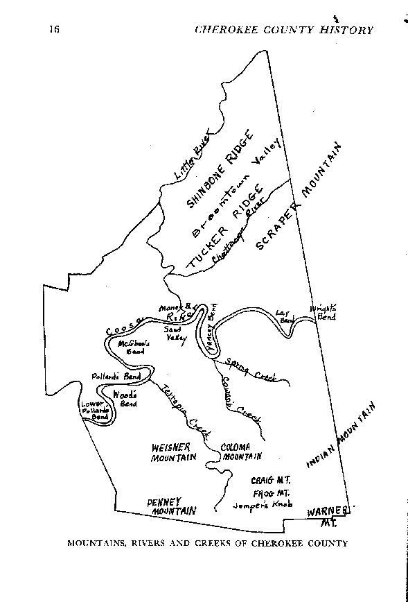
The map shows features as they were before 1960, when Weis Lake was created. I had an uncle who grew cotton in that hairpin just east of Sand Valley, and just south of Cedar Bluff. The soil was delightfully loamy. This map also comes from "Cherokee County History 1836-1956," (vol. 1) by Mrs. Frank Ross (Margaret) Stewart, published 1958.